What does McLane instrument data look like? How are the instruments used in the field? Check out our new reference sheet and experience live McLane instrument data from 5 active projects at sea from your smartphone or computer.
QR codes provide direct navigation to project web sites where current and real-time data includes:
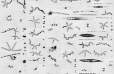
- Live Imaging FlowCytobot (IFCB) image streams from University of Texas shellfish monitoring and protection, University of Rhode Island, and the Martha’s Vineyard Coastal Observatory (MVCO).
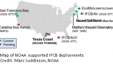
- Interactive Global IFCB deployment map of static systems and shipboard deployments.
- Ongoing Environmental Sample Processor (ESP) time-series data showing estimated Alexandrium fundyense cell concentrations in Northern Maine.
- Active Ice Tethered Profiler (ITP) data from the Woods Hole Oceanographic Institution (WHOI) ITP web page. Data is used for critical information on the physical properties of the Beaufort Gyre’s currents, chemistry, life forms, and ice.
- Profiler sensor data collected at research arrays from the Pioneer Array (south of Cape Cod), the Argentine Basin, Irminger Sea, Southern Ocean, Station Papa and more.
McLane manufactures time-series in situ oceanographic instrumentation for scientific deployments in the open ocean, and freshwater environments. Three main oceanographic product lines are available: profilers, samplers and flotation. Contact McLane for more information.


