Prawler Deployment Data
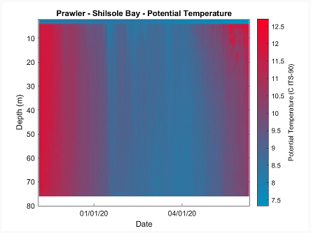
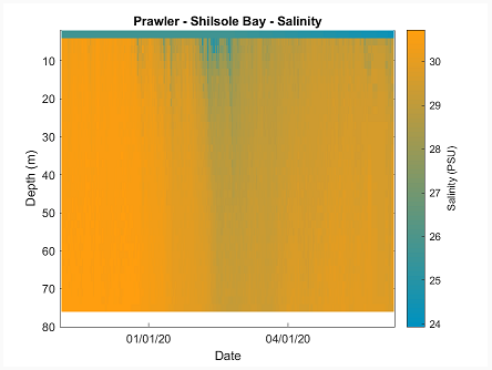
See Prawler temperature and salinity data from Shilshole Bay, Puget Sound, Seattle, WA. Data are transmitted inductively to a NOAA/PMEL surface controller, then onto shore using Iridium / RUDICS to NOAA’s facilities in Seattle, WA.
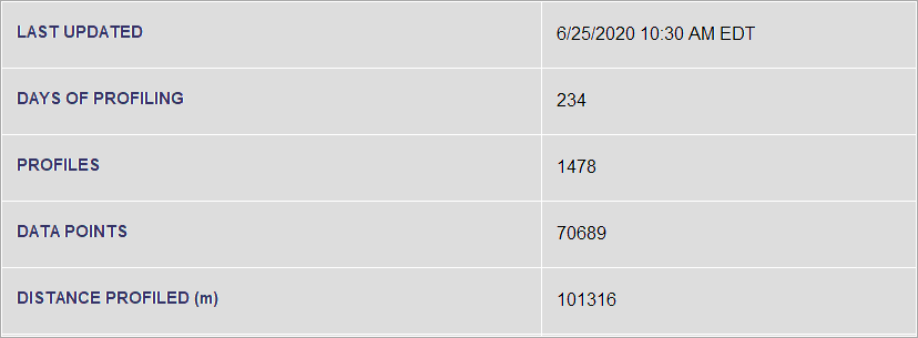
The McLane-manufactured Prawler transmitted 234 days of real-time data starting in October 2019 in this joint NOAA/PMEL and McLane initiative. Recovery was in June 2020. The Prawler technology transfer is part of a Cooperative Research and Development Agreement between NOAA/PMEL and McLane.
Prawler averaged 7.6 profiles per day, profiling from the near surface to a depth of about 75m. Each profile contains approximately 50 data points. Learn more about this deployment.
 |
 |
Deployment data summary

